Trail Walking Le Fau - la roche - Photo
 Iahns
Iahns

User

© OpenStreetMap contributors
Length
Length
8 km
Max alt
Max alt
1191 m
Uphill gradient
Uphill gradient
286 m
Km-Effort
Km-Effort  
11.8 km
Min alt
Min alt
934 m
Downhill gradient
Downhill gradient
286 m
Boucle
Boucle
Yes
Creation date :
2017-08-25 00:00:00.0
Updated on :
2017-08-25 00:00:00.0

(0 Reviews)

Walking
Walking
2h35
Difficulty : Easy

Scan this QR Code to open this trail in the SityTrail application

FREE GPS app for hiking

Logo SityTrail SityTrail

IGN / Geographical institutes

Download SityTrail from the App Store Download SityTrail from Google Play

Logo SityTrail SityTrail World

The world is yours!

Download SityTrail from the App Store Download SityTrail from Google Play Download SityTrail on Huawei AppGallery

About

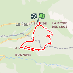
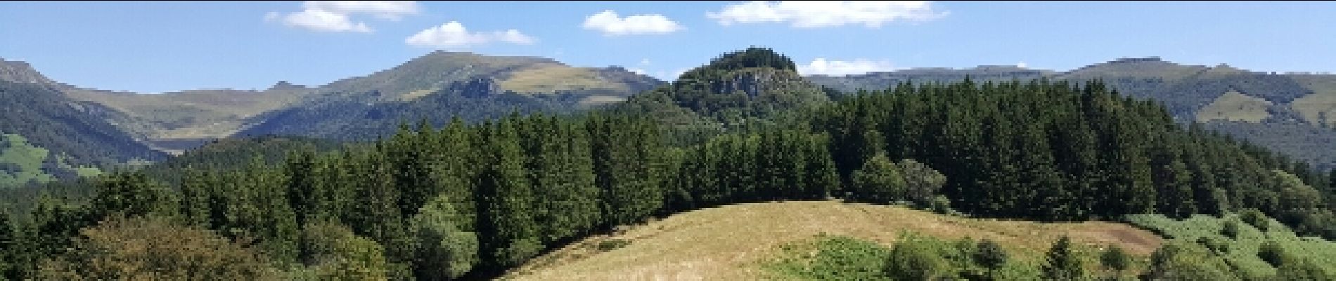
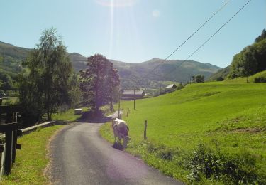
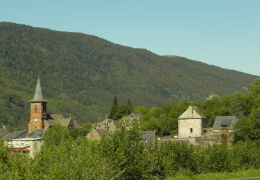
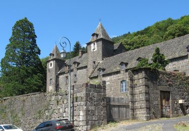
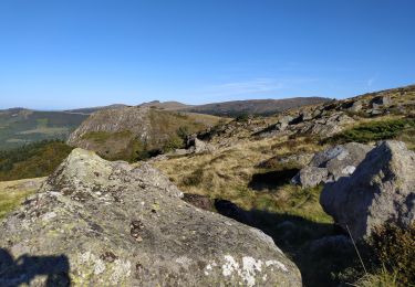
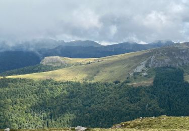
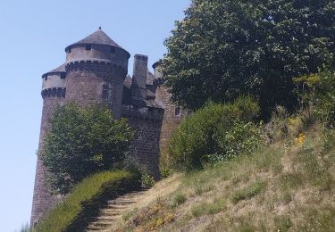
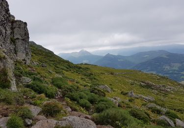
Trail Walking of 8 km to be discovered at Auvergne-Rhône-Alpes, Cantal, Le Fau. This trail is proposed by Iahns.

Description

Très belle balade avec un magnifique point de vue au dessus du hameau de la Roche

Elevation profile

Photos

Positioning

Country:
France
Region :
Auvergne-Rhône-Alpes
Department/Province :
Cantal
Municipality :
Le Fau
Location:
Unknown
Start:(UTM)
468044 ; 4994441 (31T) N.

Trails nearby

Trail On foot Le Falgoux - Sentier de la cascade du Biaguin - Photo
On foot
PRO

On foot

Easy
Le Falgoux, Auvergne-Rhône-Alpes, Cantal, France
3.8 km | 5.5 km-effort
1h 14min
Yes
Trail On foot Le Falgoux - La Baladie - Photo
On foot
PRO

On foot

Easy
Le Falgoux, Auvergne-Rhône-Alpes, Cantal, France
10.9 km | 18.5 km-effort
4h 11min
Yes
Trail On foot Saint-Projet-de-Salers - Sur la route des transhumances étape 3 - Photo
On foot
PRO

On foot

Easy
Saint-Projet-de-Salers, Auvergne-Rhône-Alpes, Cantal, France
12.4 km | 17.9 km-effort
4h 3min
No
Trail Walking Saint-Paul-de-Salers - 11.08.2013 - Photo
Walking
robertserre

Walking

Easy
(1)
Saint-Paul-de-Salers, Auvergne-Rhône-Alpes, Cantal, France
10.6 km | 15.6 km-effort
3h 7min
No
Trail Walking Le Falgoux - le falgoux - Photo
Walking
robertserre

Walking

Easy
(1)
Le Falgoux, Auvergne-Rhône-Alpes, Cantal, France
7.8 km | 10.4 km-effort
2h 22min
Yes
Trail Walking Le Fau - Puy violent  - Photo
Walking
sdroneau

Walking

Very difficult
Le Fau, Auvergne-Rhône-Alpes, Cantal, France
22 km | 37 km-effort
8h 29min
Yes
Trail Walking Saint-Projet-de-Salers - Col de Legal Cabrespine  - Photo
Walking
GUIDE
antignacs

Walking

Very easy
Saint-Projet-de-Salers, Auvergne-Rhône-Alpes, Cantal, France
8.2 km | 13.6 km-effort
2h 43min
Yes
Trail Hybrid bike Mandailles-Saint-Julien - Tournemire  - Photo
Hybrid bike
nadd73

Hybrid bike

Medium
Mandailles-Saint-Julien, Auvergne-Rhône-Alpes, Cantal, France
39 km | 50 km-effort
3h 2min
No
Trail Walking Saint-Projet-de-Salers - Col de Legal vers le Puy de Chavaroche - Photo
Walking
tbrunet

Walking

Medium
Saint-Projet-de-Salers, Auvergne-Rhône-Alpes, Cantal, France
8.5 km | 13.8 km-effort
3h 8min
Yes


Close
My subscriptions